Snapshots of a Geological Moment: Indian Creek Geology | Excerpts from Creek Freak
Posted by Alan Lester on 14th Apr 2023
First published in Creek Freak, Indian Creek Climbs in 2018.
Many times I’ve battled up some splitter crack only to feel my fingers or a hand slowly sliding out of a tenuous jam, ten or more feet above my last cam and struggling to place the next piece before I go airborne. In the midst of it all, the last thing that I’m thinking about is how these stupid sand grains, barely clinging to skin or tape, came to be here!
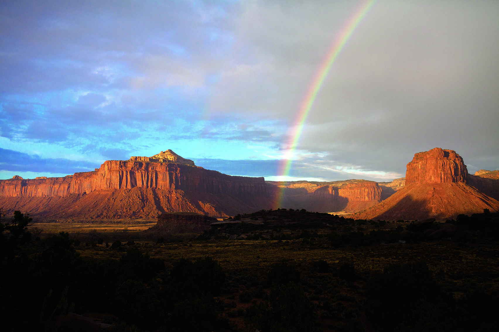
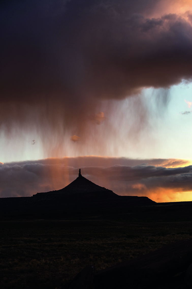
But whether driving down from Moab with the desert landscape coming into view, or while walking back from the crag (with a pleasant touch of adrenaline still lingering), or during a quiet morning with the sun just starting to light up the other-worldly beauty of the brown-red Wingate walls, it’s a kind of privilege to be able to appreciate the deep geologic history of this place. The following are a few geological thoughts that might help you enjoy the same.
It all starts with the origin of continental crust in this area, nearly two billion years ago and almost half the age of earth. For some reason, still rather enigmatic, a roughly circular chunk of this crust, comprising well over 100 thousand square miles and called the Colorado Plateau, has behaved as a rigid block that has been fairly resistant to buckling and folding. On the Plateau we find layer upon layer of relatively un-deformed flat-lying sediments, whereas there is no shortage of rock deformation and contortion to the north and east (the Rocky Mountains) and to the south and west (the block-faulted Basin and Range). The entire Colorado Plateau has been lifted, like a platter atop a waiter’s hand, along with much of the western U.S., to elevations several thousand feet above sea level. This “tectonic setting” is key to understanding how the Wingate Sandstone cliffs of Indian Creek came to be here, and why they are home to what is arguably some of the world’s most unique and iconic rock-climbing routes.
The various geologic sub-units that make up the layers of rock in Indian Creek were deposited during dinosaur-time, specifically the Late Triassic and Early Jurassic periods of the Mesozoic Era (approximately 210–150 million years ago). As a consequence of plate tectonic motion, the slow but inexorable “dance of continents,” during the deposition of these strata North America was sitting nearly astride the equator. Things were warm, and major mountain uplifts were relatively distant (e.g. the Appalachians to the east and some early crustal flexures to the west)—the upshot being that this was a relatively low-elevation region, what geologists call a subsiding basin, into which river or marine or windblown sediment easily collected. As a matter of fact, most of western North America was warm and low, and over the millennia with the rise and fall of sea level, ocean water poured onto and off the continent. Between these oscillating incursions of sea-water, the landscape was covered by enormous Saharan-scale masses of windblown and drifting sand dunes (often referred to as “ergs” from the Arabic word for dune-field) that covered literally thousands of square miles. From oldest to youngest, the solidified (i.e., lithified) remains of these ancient dune fields are the famous rock units called the Wingate, Navajo, and Entrada formations; all distinct and separated from each other by intervening layers of river or stream or lake deposits.
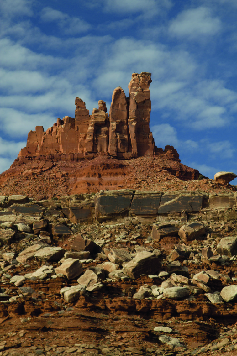
The showcase rock for Indian Creek climbing is of course the Wingate Sandstone. It’s present all across the Colorado Plateau, found from Capitol Reef to Canyonlands National Parks, and eastward into Colorado National Monument. In terms of mineral content, the Wingate is composed of pretty much nothing but grains of quartz, and all of nearly the same fine-grain size (approximately 0.05–0.07mm diameter).
Although not quite as well exhibited as in the younger (overlying) Navajo Sandstone, the Wingate contains the characteristic dramatic, steeply-angled bedding patterns termed cross-beds. It’s these cross beds, combined with the quartz-rich composition and grain-size distribution, that served as key fingerprints in the “court of science” to bring a resounding verdict of guilty-as-charged—these were undoubtedly inland desert wind-blown dunes being pushed to and fro across the land (in fact, analyses of prevailing wind direction suggests a more east-to-west flow than exists today).
Furthermore, the homogeneous composition and cementation (the mineral “glue” holding the grains together) is one of the reasons that this rock breaks in a particularly regular fashion, forming vertical cracks called joints. It’s important to remember that during the nearly 200 million years since its deposition, this rock unit has been buried by up to several kilometers of overlying rock, and it is only exposed today as a consequence of erosion and uplift. The removal of overlying rock, and the uplift of the Colorado Plateau itself, has released enormous amounts of confining pressure causing expansion and the formation of innumerable vertical cracks and corners. Think of the poor Wingate Sandstone, finally getting rid of its pressing burden, breathing a sigh of relief, and rewarding climbers with some of the most awe-inspiring vertical fissures on the planet.
We can’t forget about those long, arduous talus slopes that must be endured in order to get to most Wingate walls. Instead of worrying about building unnecessary leg muscles (while trudging upwards under heavy cam-filled packs) it’s worth noting that some rock units are much more resistant to erosion and others have a tendency to crumble away rather easily. This seemingly simple idea of “cliff-forming units” versus “slope-forming units” is really the basis of understanding landscape evolution (a whole field of science called geomorphology). The slope-forming unit beneath the Wingate cliffs is the Triassic Chinle Formation. As you walk up to the climbing routes, you can often catch a glimpse of the red and crumbly Chinle rocks weathering out beneath large blocks of Wingate Sandstone that have fallen or slid down from above. The Chinle is a mixed bag including shale, siltstone, sandstone, and even conglomerate; it’s also composed of a vastly more diverse mineral assortment than the overlying quartz-pure sand-dune deposits. These are dominantly fluvial sediments, meaning that they are derived from rivers and streams of all sizes and gradients, but also with a smattering of lake and wind-blown sediments. Unlike the Wingate, the Chinle contains quite a trove of fossil material, most famously petrified wood. Additionally, and akin to the Moenkopi Formation located beneath, these are classic “red-beds”—containing iron-minerals that were effectively “rusted” by interaction with oxygen-rich groundwater during the process of lithification. For reasons that are still debated, this early Mesozoic time, the Triassic Period (about 200–250 million years ago) is rife with red-beds.
Lastly, as much as we might appreciate the geological story of Indian Creek and the Colorado Plateau, one has to remember that the rocks we see are a very limited record of earth history. They are merely snapshots of geological moments, when sedimentation won out over erosion, and they can only provide clues as to what was happening during relatively narrow and isolated windows into an immense span of time. Nevertheless, they’ve been here long before us and will be here long after us (and of course I’m not referring to you and me, but instead to the human species) and they are worth enjoying not only with our bodies, but also with our unique ability to know something about their origins. Have fun!